Best ways to get to the London Eye | Location, directions & more

Where is the London Eye located?

Address: Riverside Building, County Hall, London SE1 7PB, United Kingdom

Find on Maps

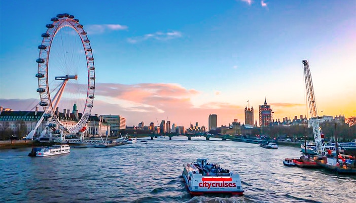
The area around the London Eye is vibrant and bustling, with plenty of shops, restaurants, and other attractions nearby. The location of the London Eye is easily accessible by various modes of transportation, making it a convenient destination for both locals and tourists.

Nearest landmark: Big Ben

Plan your visit to the London Eye

Getting to the London Eye by public transportation

  • Best for: Saving time, navigating city traffic, and direct access
  • Travel time (from Trafalgar Square): Approximately 5-10 mins 
  • Closest stop: Waterloo (Jubilee, Bakerloo, Northern, Waterloo & City lines) 
  • Timings: Generally operates from early morning (around 5am) until around midnight or later, depending on the line and day of the week. 

From Trafalgar Square, walk to Charing Cross tube station (2 mins). Take the Bakerloo line southbound one stop directly to Waterloo Station. The London Eye is a short 5-7 min walk from the South Bank exit of Waterloo Station, following signs.

  • Best for: Longer distance commutes into central London
  • Closest stop: Waterloo Station 
  • Timings: Varies significantly by line and destination, typically early morning until late evening/midnight

If you're arriving in London via national rail, Waterloo Station is the most convenient hub. From there, follow the clear signs to the South Bank, and the London Eye is just a short stroll across the road. This makes it ideal for visitors coming from outside central London.

  • Best for: Budget travel, sightseeing 
  • Travel time (from Trafalgar Square): Approximately 10-20 mins (depending on traffic)
  • Closest stops: Westminster Bridge Road, York Road, or Waterloo Station
  • Timings: Most routes run from early morning (around 5am) until late night (around midnight), with some 24-hour services

Numerous bus routes serve the London Eye area. From Trafalgar Square, you can catch buses like the 12, 148, or 159 (heading south) towards Westminster Bridge. Alight at the Westminster Bridge Road stop, and the London Eye is a very short walk away on the South Bank.

  • Best for: Unique sightseeing, relaxed travel
  • Travel time (from Embankment Pier, near Trafalgar Square): Approximately 5 mins
  • Closest stop: London Eye Pier
  • Timings: Operating hours generally run from early morning until late evening, with varying frequency. 

For a scenic approach, head to Embankment Pier, which is a 5-min walk from Trafalgar Square. Catch a Thames Clippers service directly to the London Eye Pier. It offers fantastic views of riverside landmarks as you approach and drops you right at the base of the London Eye.

Getting to the London Eye by car

  • Best for: Specific needs, large families with gear
  • Travel time (from Trafalgar Square): Approximately 10-15 mins
  • Distance: 2.4 km

Head southeast on Whitehall towards Parliament Square. Turn left onto Parliament Street, then cross Westminster Bridge (A302). The London Eye will be immediately on your left. Note that driving in Central London incurs the Congestion Charge.

Parking facilities:

  • No on-site parking: The London Eye itself does not have parking.
  • Nearby car parks (Paid):
    • Union Car Parks - Coin Street: Nearby on the South Bank. 5-min walk.
    • South Bank Centre Car Park: On Belvedere Road. 5-7 min walk.

Cycling to the London Eye

  • Best for: Exploring the city actively, enjoying fresh air, avoiding traffic, and eco-friendly travel
  • Travel time (from Trafalgar Square): Approximately 5-8 mins.
  • Distance: Approximately 1.6 km

Cycling to the London Eye offers a fantastic way to soak in the vibrant atmosphere of central London. From Trafalgar Square, head towards Parliament Square via Whitehall. Cross the Westminster Bridge, and the London Eye will be immediately visible on your left on the South Bank.

London has a growing network of cycle lanes and Santander Cycles (hire bikes) available for easy access. Remember to use cycle lanes where available and be aware of traffic. Bike racks are found near the South Bank.

Walking to the London Eye

  • Best for: Soaking in the atmosphere, budget-friendly, leisurely sightseeing
  • Travel time (from Trafalgar Square): Approximately 15-20 mins
  • Distance: Approximately 1.3 km

A walk from Trafalgar Square to the London Eye allows you to experience some of London's most famous sights on foot. Head south from Trafalgar Square down Whitehall, passing Downing Street and the Cenotaph. You'll soon reach Parliament Square, with Westminster Abbey and the Houses of Parliament on your left. Cross Westminster Bridge, and the London Eye stands on the South Bank, offering photo opportunities along the way.

Travel time: 25 mins

Take the London Underground from King's Cross St. Pancras Station to Waterloo Station. Once you exit Waterloo Station, follow the signs to the South Bank. This will take you down the stairs and through the station concourse. Turn left and continue walking along the South Bank until you reach the London Eye.

Travel time: 20 mins

Take the Bakerloo Line from Oxford Circus station towards Elephant & Castle station. Get off at Waterloo Station. Exit Waterloo station following the signs for the South Bank. Walk along the South Bank until you reach the London Eye.

Travel time: 10 mins

  • Exit Waterloo Station through the main concourse towards the South Bank exit. Follow the signs to the South Bank, which will lead you down a set of stairs and onto the street. 
  • Turn left and walk along the South Bank for approximately 10 mins. The London Eye will be visible on your right-hand side.

Travel time: 25 mins

  • Take the Bakerloo Line from Paddington Station towards Elephant & Castle Station. Get off at Waterloo Station. 
  • Exit Waterloo station following the signs for the South Bank. Walk along the South Bank until you reach the London Eye. The walk should take around 10 to 15 mins.

Travel time: 15 mins

  • Take the London Underground from Victoria Station to Westminster Station. Once you exit Westminster Station, follow the signs to the South Bank. 
  • When you reach the street, turn right and continue walking along the South Bank until you reach the London Eye.

Travel time: 25 mins

  • Take the Northern Line from Euston station towards Kennington station. Get off at Waterloo Station. 
  • Exit Waterloo station following the signs for the South Bank. Walk along the South Bank until you reach the London Eye.

What is the best way to get to the London Eye?

The best way to reach the London Eye depends entirely on your priorities. Here's a guide to help you choose the ideal transport option for your visit:

London Tube train arriving at a bustling underground station in London, England.

For the fastest route

If speed is your main concern, especially from within central London, the Tube (Underground) is your best bet.

  • Mode: Tube (Underground)
  • Closest station: Waterloo Station (Jubilee, Bakerloo, Northern, Waterloo & City lines)
  • Why choose it: The Tube network is extensive and designed for rapid transit across the city, largely avoiding surface traffic. Waterloo is a major hub, offering direct connections from many parts of London. From the station, the London Eye is a very short, well-signposted walk.
Guide overlooking the London Eye and Thames River on a city walking tour.

For the budget traveler

For those looking to keep costs down while exploring, a combination of walking and bus travel offers excellent value.

  • Mode: Walking & bus
  • Why choose it: Walking is, of course, free! London's bus network is extensive and offers affordable fares (especially with an Oyster card or contactless payment), allowing you to see the city from street level without the higher cost of taxis or ride-hail. You can combine a walk from a nearby landmark with a short bus ride if your starting point is further away.
River cruise on the Thames with view of the London Eye and city skyline.

For sightseeing and soaking in the city

If you want your journey to the London Eye to be part of the London experience itself, walking or taking a River Boat is a great choice.

  • Mode: Walking or by boat
  • Why choose it:
    • Walking: A stroll from nearby Trafalgar Square or Westminster allows you to pass landmarks like Downing Street, Parliament Square, and cross Westminster Bridge, offering countless photo opportunities before you even reach the Eye.
    • River Boat (Thames Clippers): This offers a unique perspective, providing views of the city's riverside architecture and bridges from the water as you approach the London Eye Pier directly. It's a relaxing and scenic way to travel.

Frequently Asked Questions about the London Eye's location

What famous landmarks are closest to the London Eye?

The London Eye is directly opposite the Houses of Parliament and Big Ben, separated by Westminster Bridge. It's also very close to Westminster Abbey, and just a short walk along the South Bank to attractions like SEA LIFE London Aquarium and Shrek's Adventure! London.

What's the best way to get to the London Eye by public transport?

The Tube (Underground) is generally the fastest and most convenient way. Waterloo Station is the closest and most recommended Tube and National Rail station, just a 5-7 min walk away. Buses and riverboat services also offer excellent access.

Is it easy to find the London Eye once I arrive at Waterloo Station?

Yes, once you arrive at Waterloo Station (whether by Tube or National Rail), simply follow the clear signage directing you towards the "South Bank" exit. The London Eye is prominently visible from the South Bank promenade, and you'll easily spot its wheel.

Are there family-friendly transport options?

Yes, family-friendly transport options, such as buses and river cruises, provide a comfortable journey to the London Eye.

Is public transport to the London Eye accessible for people with mobility issues?

Most London Underground lines and buses have accessible routes, particularly the Jubilee line at Waterloo. Waterloo Station itself has step-free access from the platforms to the exits. River boats also generally offer good accessibility. It's always best to check the TfL website for specific accessible routes on your travel date.

Are there maps or apps that can help me navigate to the London Eye?

Absolutely. Google Maps is excellent for real-time directions via all transport modes (walking, cycling, public transport, driving). The Transport for London (TfL) Go app is also highly recommended for detailed public transport journey planning, including live updates and accessibility information for the Tube and bus networks.

What if I arrive late for my booked time slot?

It's always best to arrive 15-30 mins before your slot. However, if you anticipate being slightly late, contact the London Eye customer service if possible. Generally, late arrivals may not be guaranteed immediate access and might have to wait for the next available slot, or even be asked to rebook, especially during busy periods. Flexi fast-frack tickets can offer a little more flexibility in these situations, allowing you to visit at any time on the day you select.

Top Things to do in London
Top Attractions in London:
Attractions in London:
Entertainment:
Best Tours in London:
Transportation:
Other Popular Airport Transfers in UK:

Information

All screenshots of maps found on this page are sourced from Google in accordance with fair use. All rights to such screenshots lie with the specific platform, and their use is solely for informational or guidance purposes.

London Tickets
Scan code
Download the Headout app

Get Help 24/7

We Accept
VISA
MASTERCARD
AMEX
PAYPAL
MAESTROCARD
APPLEPAY
GPAY
DISCOVER
DINERS
IDEAL
FPX
Headout is an authorized and trusted partner of the venue, offering curated experiences to enjoy this attraction. This is not the venue's website.